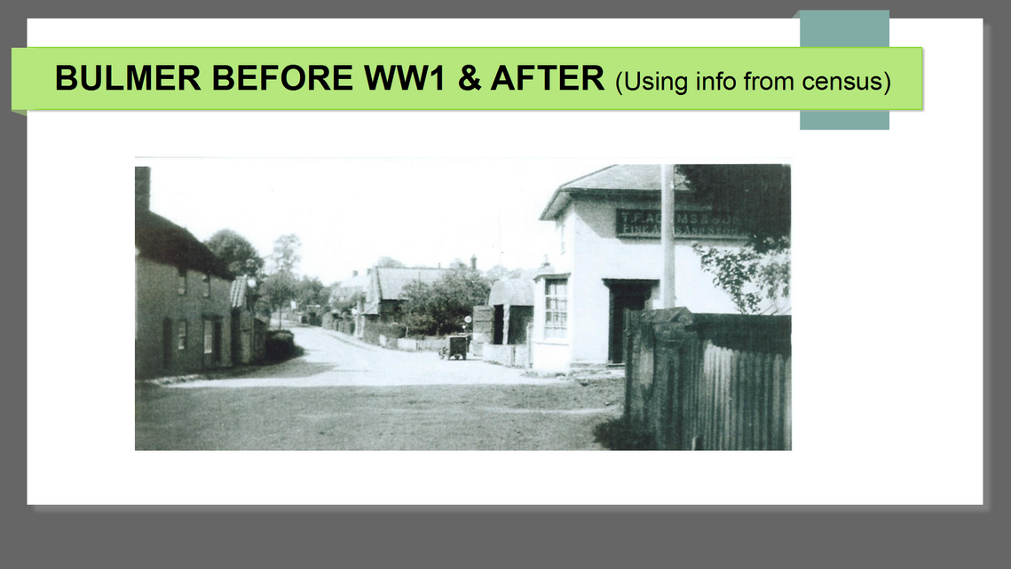
Bulmer before WW1 and after in 1921 a presentation using analysis of census information.
Bulmer in 1911 and 1921
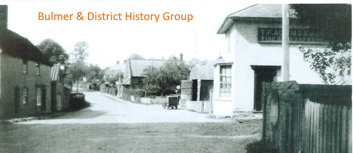
This presentation is prepared from censuses taken in1911 and 1921, its uses statistics and information from the residents of Bulmer, but not pictures, instead we have added some from our achieves.
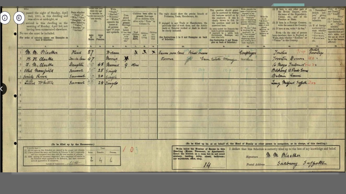
This shows an example of a completed page of the census in this case Goldingham Hall 1911, a little difficult to read.
Fortunately they have been transcribed by “Find my Past” into downloadable spreadsheet form for each entry, with some errors like Pinch Hill not Finch Hill.
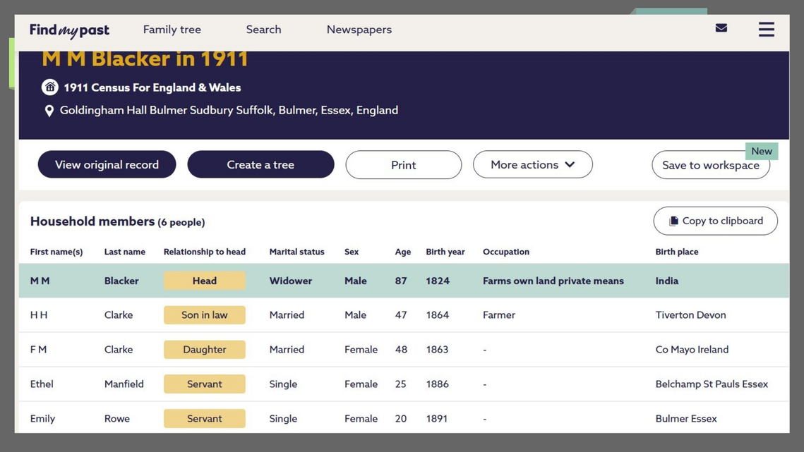
This is that record transcribed for Goldingham Hall, now able to downloaded in spreadsheet form. Which we have done for each entry for Bulmer for 1841, 1851, 1861, 1871, 1881, 1891, 1901, 1911 and 1921.
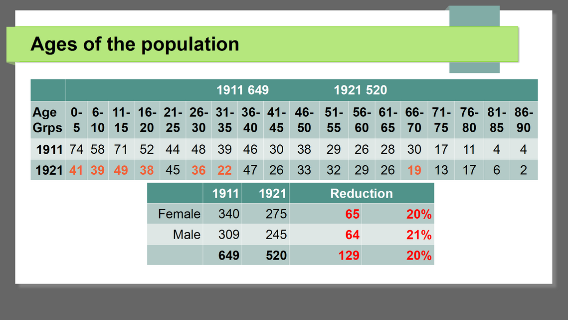
In comparing the ages of the population of Bulmer, which had shrunk by 20% for both male and females after the war, mainly in the younger age groups,
why, was this because of the depression before and after the war?Other suggestions are Flu or Smallpox epidemics
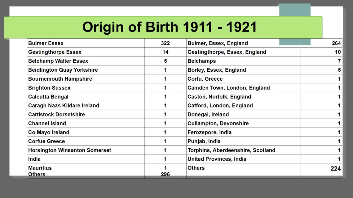
Here we see an extract of where residents were born, note the number born in Bulmer in 1911 and 1921, and those from other nationalities.
DORSETSHIRE ??
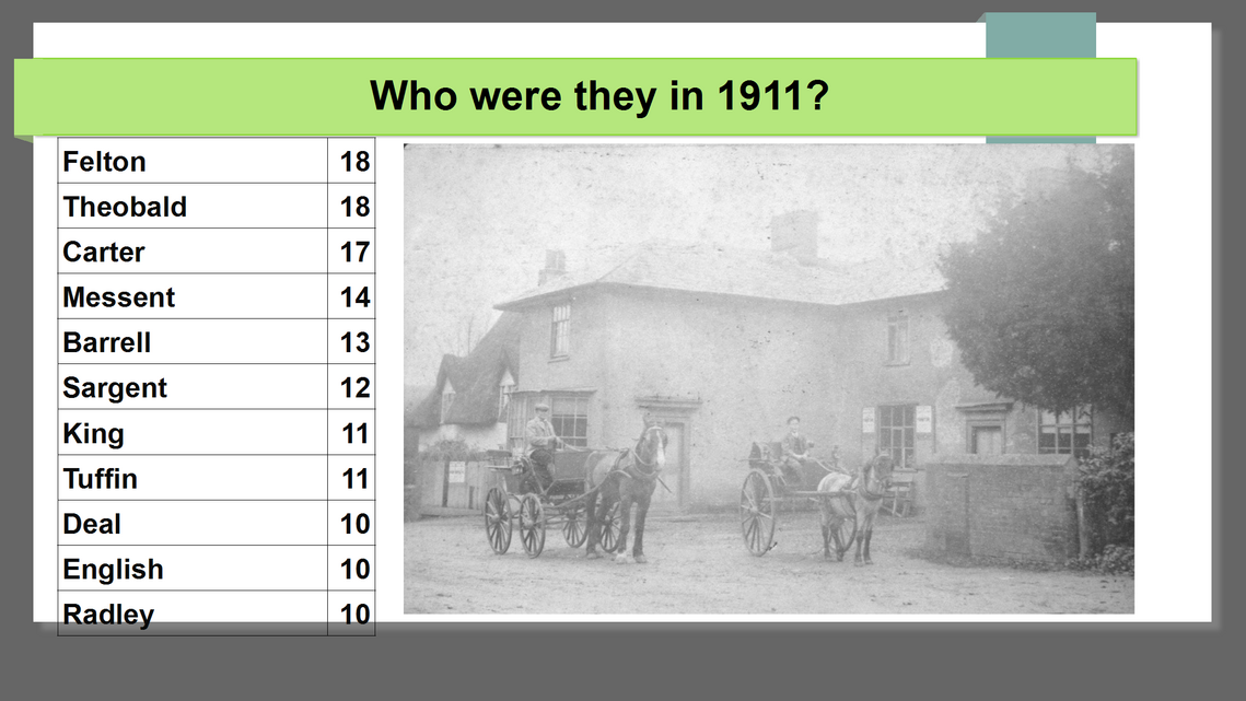
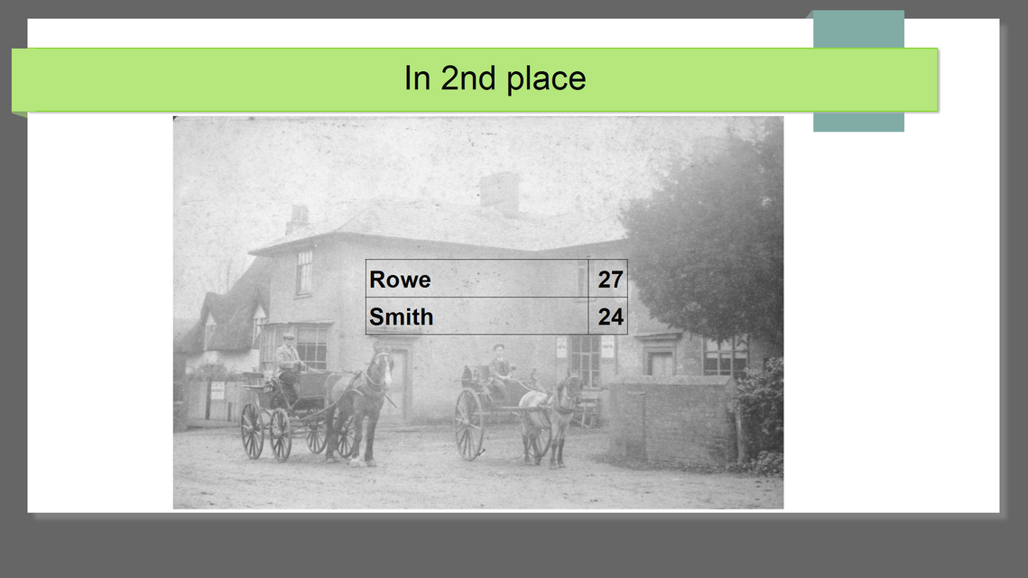
Family names were quite popular 1911, due to people not moving round, here we see some the most popular, but not the largest Families!
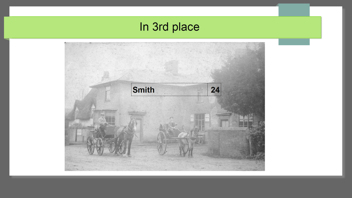
In 3rd place we have Smith 24
In joint 2nd place we have the Rowe’s with 27
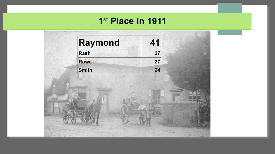
Rash with also 27, any guesses to who was the most popular name in 1911?
Its the Raymonds with 41!
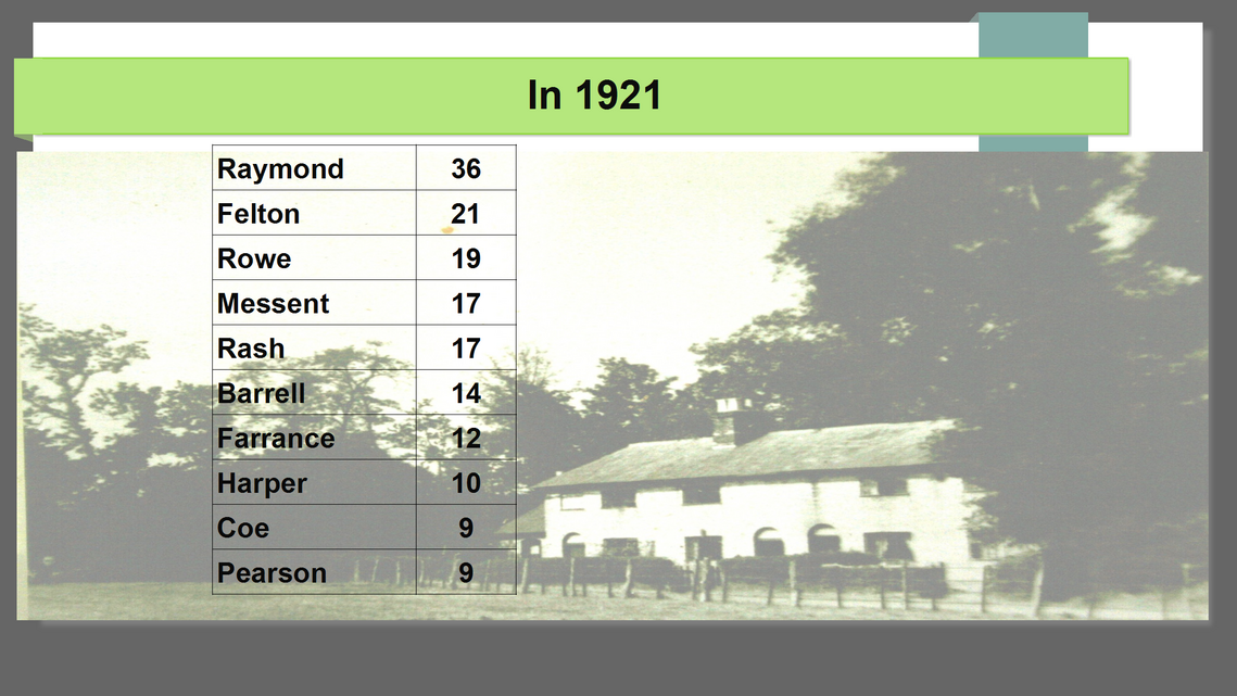
By 1921 the top 4 had reduced, but still holding the number one slot were the Raymonds!
Cottages at Armsey Farm, now gone.
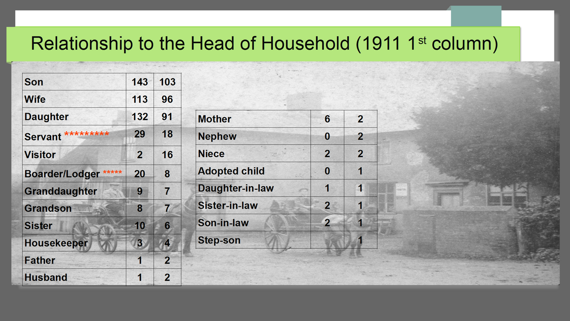
The census shows the make up of the families by the relationship to the person stated as the head of the household.
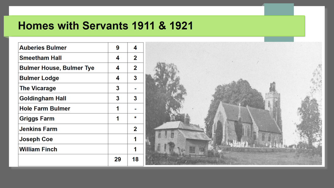
This shows the number servants for richer families and those that had lodgers, as well as 3 generations were in the same house.
Who were the families with servants?
Obviously the Auberies, then mainly farmers.
The picture is of St. Andrew’s Church and Laundry Cottage before Vicars Orchard existed.
This is a map of the time showing the Auberies Farm, smaller than today, although this was land leased from the Auberies particularly on the left next to Church Rd and north of Sandy Lane.
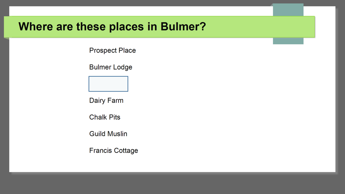
On downloading each entry from censuses from 1841, I came across some Bulmer places names we didn’t know, can anyone help?
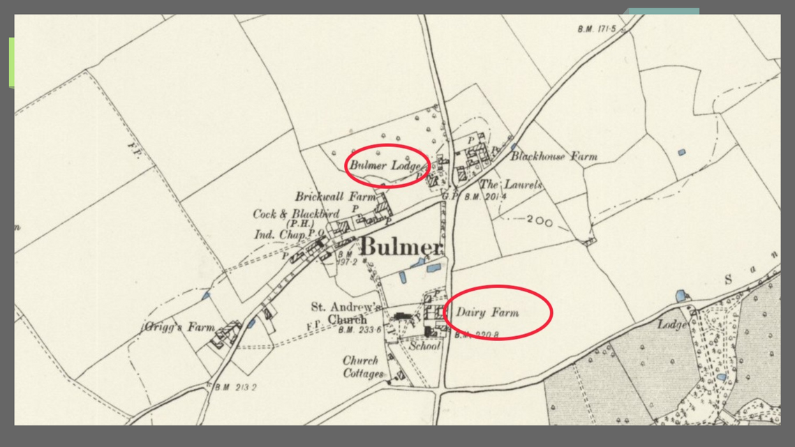
This identifies Bulmer Lodge, and Dairy Farm.
Here we see Prospect Place now Batt Hall and Old Clay Pits.
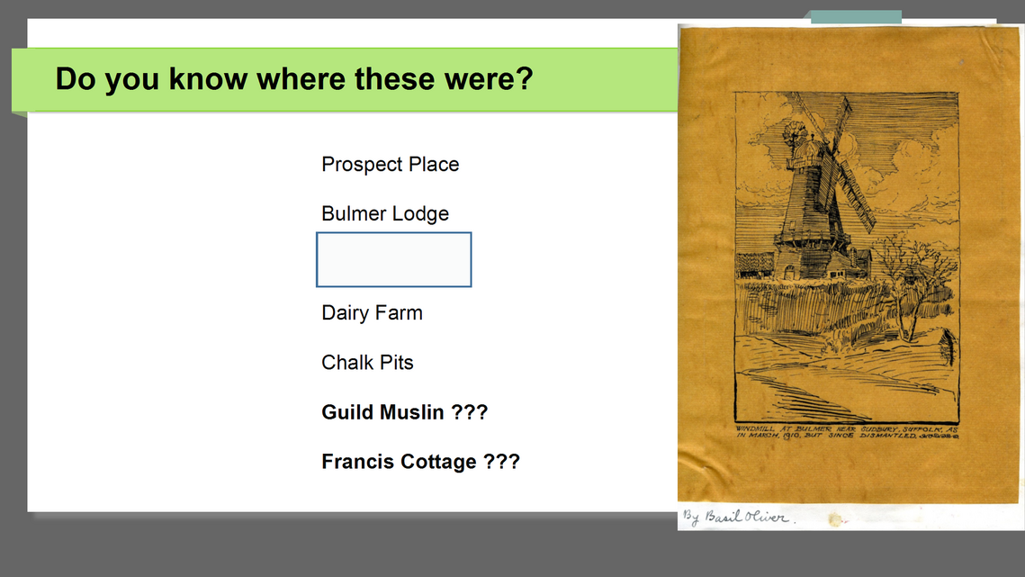
Also the site of Bulmers own Windmill, we will see a picture of this on the next slide. Note Victoria brick works.
The places we have not identified are;
Guild Muslin and Francis Cottage.
Here we see the most popular occupations declared. Obviously farming and agricultural jobs dominate., but there is a decline.
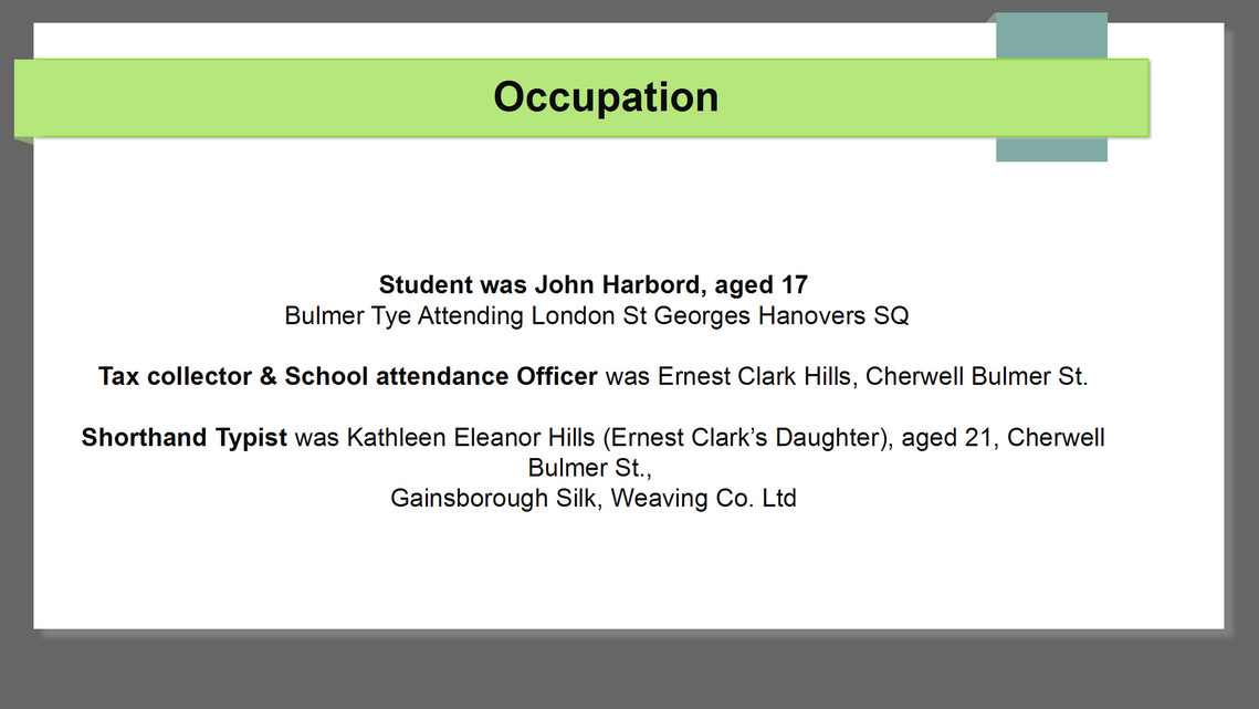
Strange no-one is attending school in 1921, but there is a school inspector!
The student was John Harbord from the Tye. Tax Collector & school inspector was Ernest Clark, his daughter was the shorthand typist, both living at Cherwell, Bulmer St.
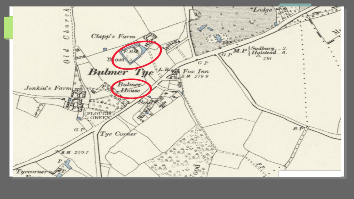
Here on this map of Bulmer Tye we see Bulmer House and note the moat surrounding Clapps Farm at the end of what is now Park lane.
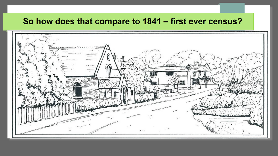
How does 1921 compare with the earliest census in 1841?
Population was 50% higher, maybe thats another presentation for the future?
This was a presentation at our meeting held on the 17th October 2025.